
 Report/Complaint
Launch of the Satellite Applications' Workshop 13th at the Centre of the Excellence for Satellite Applications (11-15 March 2018), "Tropical Cyclones"
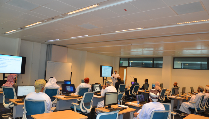
The 13th Workshop on Meteorological Satellite Applications was launched on 11th of March 2018. It is organized by the 7th Centre of Excellence for Meteorological Satellite Applications and managed by the Directorate General of Meteorology (DGMET) at the Public Authority for Civil Aviation (PACA). This workshop is held annually under the auspices of the European Organization for Satellite Applications (EUMETSAT). The workshop aims to train specialists in meteorology sciences in the Sultanate, Gulf countries and the Middle East on modern methods of satellite applications and tracking of weather conditions.
It is worth mentioning that Oman Meteorology was selected by the World Meteorological Organization (WMO) to host the 7th World Centre of Excellence for Environmental Science and Environmental Research in the region. The center was opened in February 2006 as a joint project with the DGMET at the PACA for its outstanding performance and active participation in the development of international cooperation in the field of meteorology. Besides that, it has many qualified Omani scientific cadres in this field.
During the workshop, participants will learn about various topics related to remote sensing science and its applications. It will focus on satellite applications in the analysis of tropical cyclones and follow their development in affected areas, especially by using EUMETSAT satellites. They will also be trained in the analysis of satellite images through real examples of the working environment and vivid examples of the Indian Ocean region. The lectures and supervision of training are provided by specialists from the European Organization of satellite organization, global research centers, and the DGMET.
The satellites of the European Satellite Organization cover well the Arabian Peninsula and the Indian Ocean. The data update on this region is every fifteen minutes while in some every 5 minutes. The second generation of these satellites is known for its ability to show the properties of clouds and the most comprehensive detection of natural phenomena such as tropical cyclones, winter depressions, fog, dust, and their movement. Satellite data are also included in numerical prediction models, which in turn use 70% of satellite data directly and indirectly.
Among the most important missions of the EUMETSAT are: to use these satellites in order to ensure the availability of updated images and data on weather, climate and other environmental outputs 24/7 and throughout the year for 20 of its members and 10 collaborating countries. This is due to their benefits in the air and sea navigation predictions.
By the end of this workshop, the number of cadres trained since the opening of the center will reach 273 trainees from meteorological, environmental, water resources, agriculture, universities and marine science organizations in the Middle East. It is also worth mentioning that, the satellite applications is among an expanded science application known as "remote sensing", a relatively recent term used with the launch of space imaging technology in the 1960s."Remote sensing" is defined as measuring or collecting data from objects or phenomena of interest to a device that is not directly linked to the phenomenon or object being studied. The electromagnetic, acoustic or seismic waves emitted naturally or artificially from objects or those reflected from them are used.
The importance of remote sensing science in all of its forms lies in being the cheapest and the most effective way for collecting the critical information related to the earth and its weather in determining the continuous changes in geography and climate. It also helps to continuously monitor the resources of human civilization. The rapid developments associated with it improved the identification of the locations and methods used to optimally deal with the natural disasters from floods, earthquakes, cyclones and even in traffic management.